Our Value Propositions
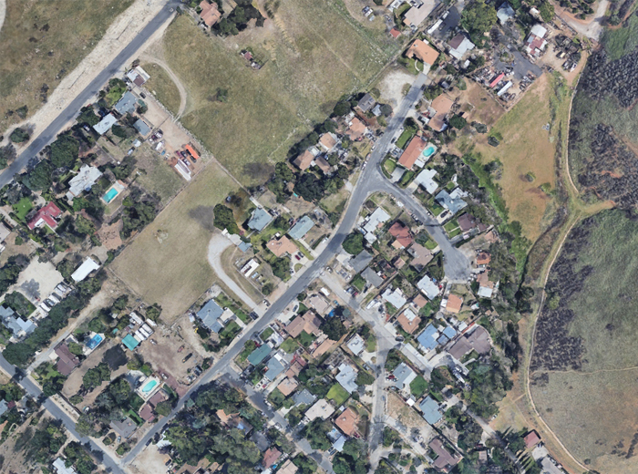
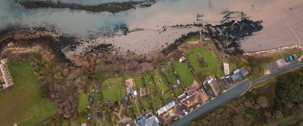
Unparalleled Precision in Wildfire Risk Assessment
FireScore.AI leverages ultra-high-resolution satellite imagery, LiDAR, and multispectral data to achieve a clarity of up to 6.78 cm. This level of detail surpasses traditional 50 cm satellite data, enabling the identification of compliance risks and fire hazards that were previously undetectable.
AI-Driven Predictive Analytics
Our proprietary AI models process vast datasets, including environmental factors and historical fire events, to predict wildfire behavior with over 95% accuracy. This predictive capability allows for proactive measures, reducing potential damage and enhancing community safety.
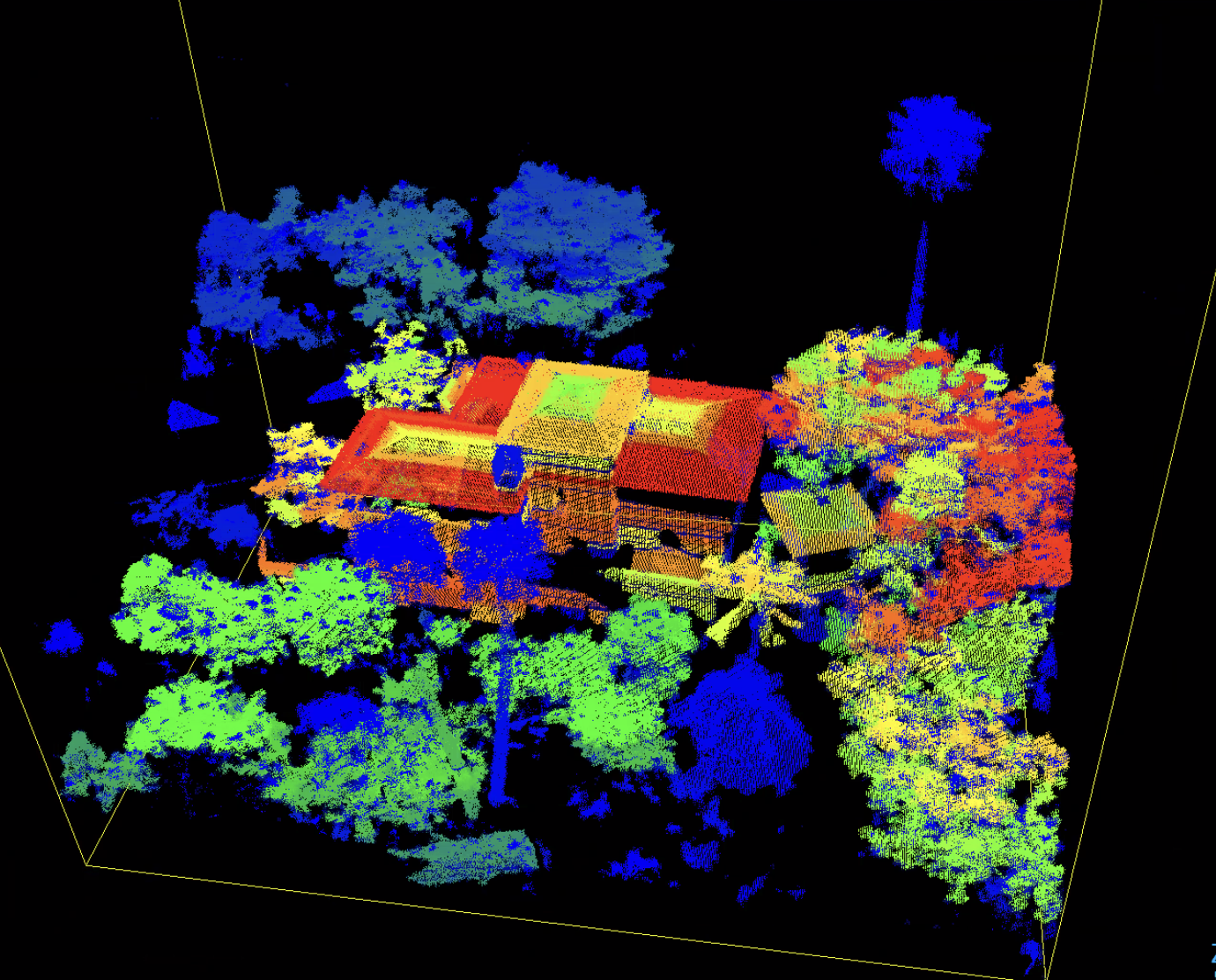
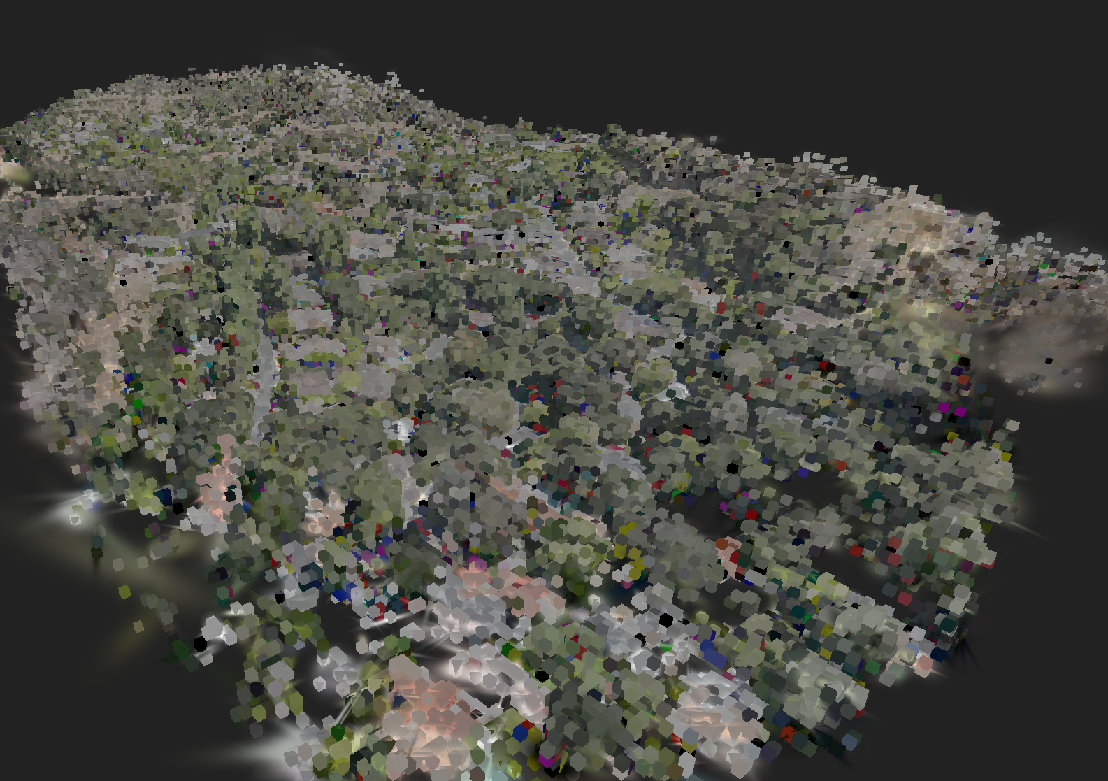
Comprehensive 3D Property Visualization
Transforming traditional 2D data into immersive 3D reconstructions, FireScore.AI offers photogrammetry, NeRFs, and Gaussian Splats, providing stakeholders with an interactive view of properties. This visualization aids in better understanding and mitigating potential fire risks.
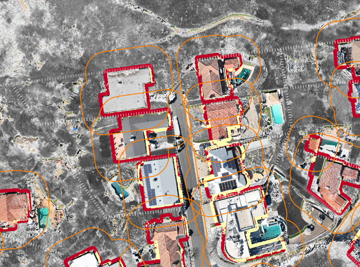
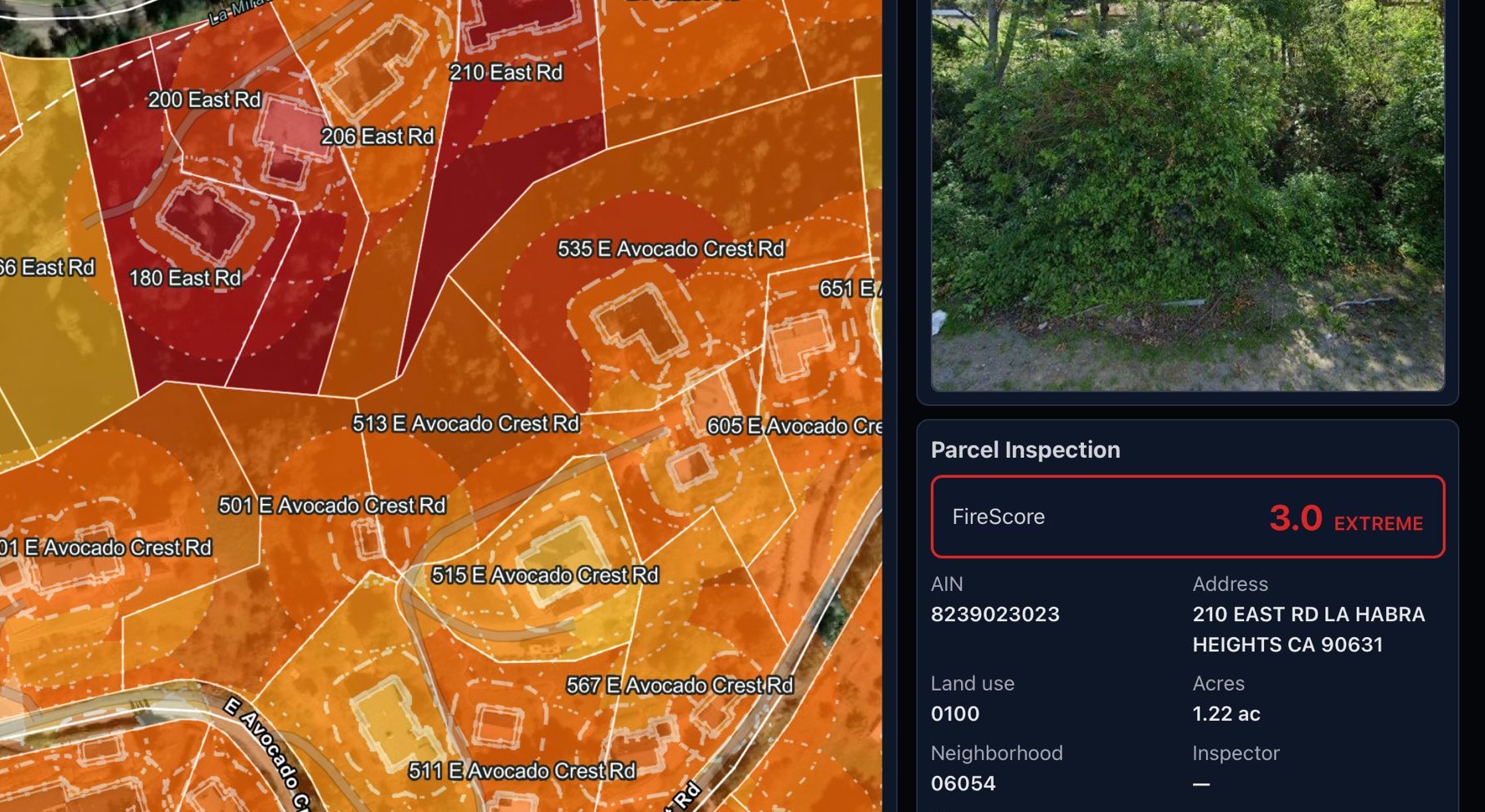
Real-Time Risk Scoring and Prioritization
Our platform assigns a dynamic FireScore to each parcel, categorizing them from high to low risk. This real-time scoring system enables fire departments and agencies to allocate resources efficiently, focusing on areas that need immediate attention.
Streamlined Compliance Reporting
FireScore.AI automates the generation of inspection-ready reports, aligning with current Firesafe Codes and local ordinances. This feature simplifies enforcement workflows and ensures timely compliance.

Integration with Existing Systems
Designed for compatibility, our platform seamlessly integrates with municipal systems, insurance platforms, and other third-party applications, facilitating a unified approach to wildfire risk management.

Collaborative Development with Fire Departments
Developed in collaboration with fire departments across Los Angeles, San Bernardino, Glendale, and La Habra, FireScore.AI incorporates real-world insights, ensuring its effectiveness in diverse scenarios.

Commitment to Privacy and Compliance
All imagery is captured by FAA-licensed pilots, and our data handling practices adhere strictly to California's privacy and curtilage laws, ensuring respect for individual privacy while maintaining safety standards.